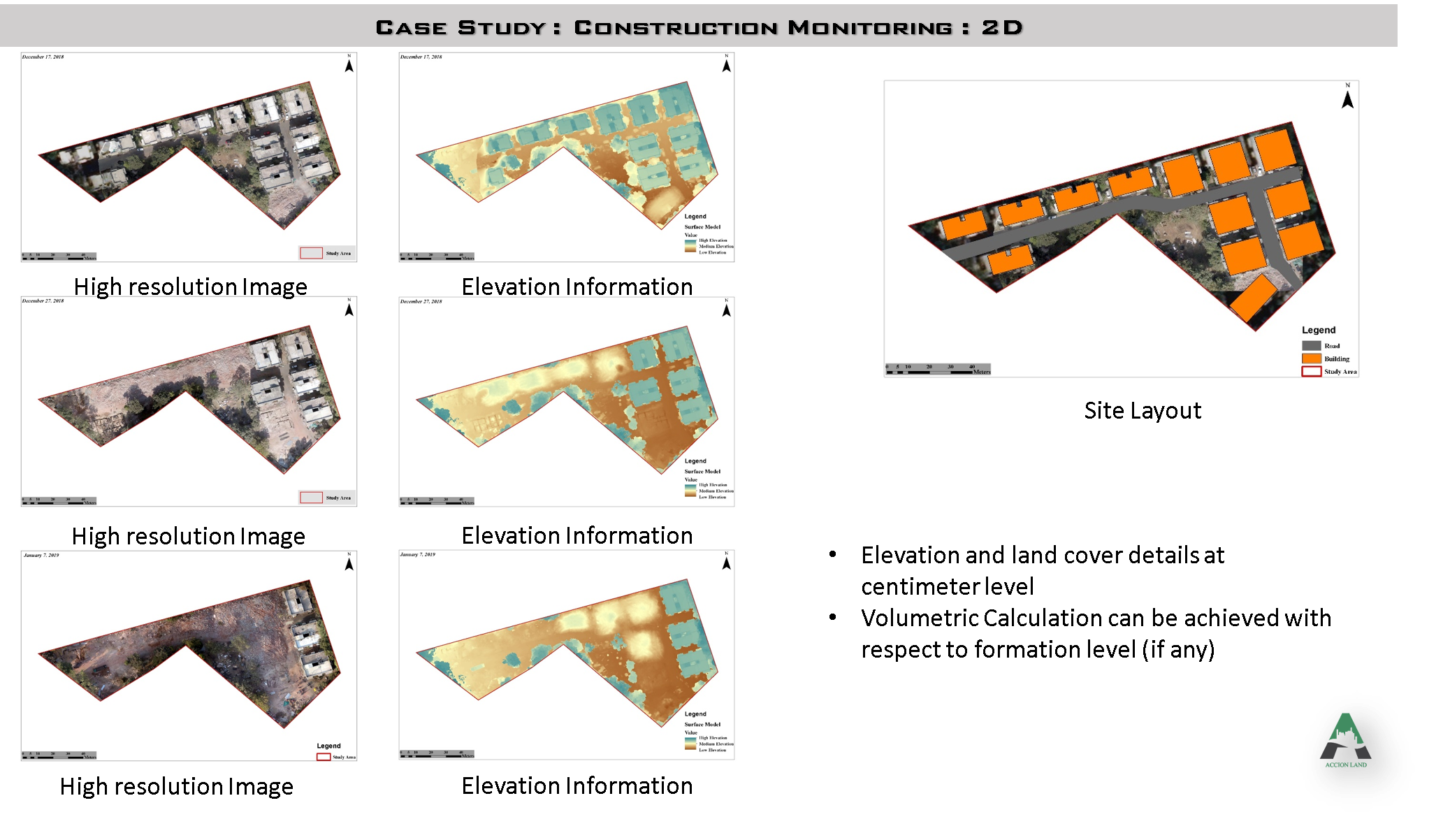
The benefits of GIS are very tangible in the construction industry, especially for project managers, site engineers and clients. For project managers, it helps evaluate the project and make sure the desired standards are met. It is a tool to review the performance of the project and its execution. A manager can quantify progress against priorities, such as the money spent versus the work done. GIS software lets a manager monitor the cost of a project and the work done, compare and evaluate the company's various projects and make sure business objectives are not compromised. With GIS integrated, comparing actual work done against cost incurred is easy, so you can check whether the project is on time or behind schedule and over budget or not, prevent unnecessary cost and control the budget. The data also helps a site engineer understand the status of the work, make decisions and monitor progress. Because the whole work process on site is tracked, any changes the site team or the client want can be made in a short period, before things get out of hand.
GIS saves a lot of resources, because the software handles the construction process, checks and monitors it, and helps complete the project on or before time. You can build a 3D model, and the tools offer pre-defined objects to understand progress, development and routing. The tools can significantly improve design coordination and execution and help resolve complex designs and challenges faced during construction. To know the exact status of a project, a manager can rely on 3D technologies, which give significant advantages in coordinating development with constructible designs and sequences. Such technology improves the quality of the project and saves as many resources as possible.
Planning, managing and executing infrastructure projects in a new era of globalization and economic liberalization demands new skills, approaches and technology. GIS can collect enough data from a spatial interface, and that data helps organize the relevant information for tracking a project. Project managers are responsible and accountable for effective and efficient delivery, and it can become cumbersome when projects are complex or need careful planning, monitoring and management. In such situations GIS works as a savior, using location as the foundation for managing data and organizing project information. 3D modelling in GRAM++ GIS software lets clients see data, visualize change over time, observe patterns and trends, and share knowledge with field personnel such as engineers and managers in a more interactive way. Today it is necessary to integrate GIS into a construction project for better management.